
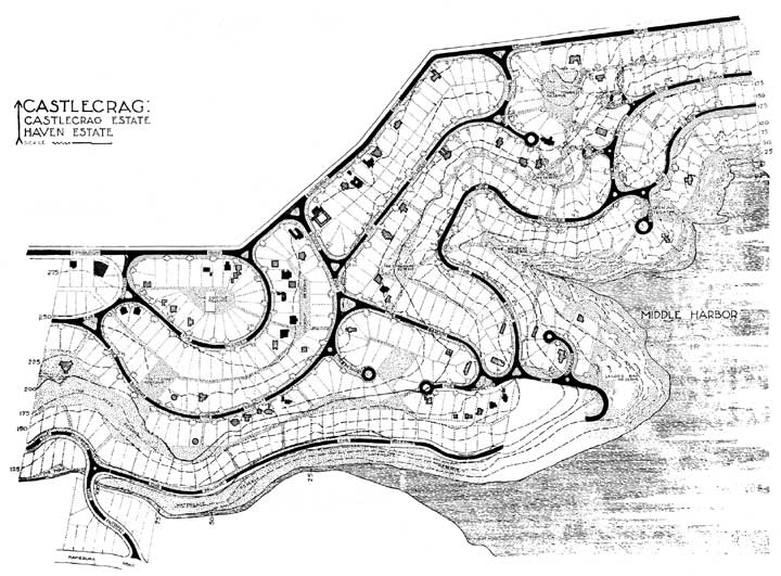
Plan of Castlecrag and Haven Estates
Photographer / artist:
Produced in the Griffin officeCopyright:
all rights reservedSource:
Walter Burley Griffin Society Incorporated Collection, courtesy Deans and Batterham familiesArchitects:
Walter Burley GriffinSubject Date:
1932Image Date:
Type:
bromide copyNotes:
Today this area is the Griffin Conservation Area. The grey dotted parts on the map represent the reserves and walkways. The black house plans are of those built, and the hatched ones are unbuilt projects.A pdf of this plan is on the Guided Tours webpage.